The Journey Before the Doorstep: How Dunbar Reaches Its Services
Access to local services is often described as a question of opening hours, eligibility or capacity. For many Dunbar households, however, the first obstacle appears before the front door is locked. The last mile — the stretch between home and the bus stop, the community transport pickup, the pavement route or the cycle path — determines whether a service is genuinely reachable. In 2026, Dunbar Neighbourhood Hub has been reviewing that stretch not as a single transport problem but as a set of practical barriers that service planners can identify, test and address.
Why the last mile deserves a closer look
Dunbar’s service landscape is concentrated in and around the town centre, but the town’s catchment is wider than its central streets. Residents in surrounding hamlets, older people, disabled people, carers and households without a car may all live within a few miles of a service yet still find it difficult to reach. The last mile is where timetables meet appointment times, where fares meet household budgets, and where pavement conditions meet mobility needs. It is also where information gaps become exclusion: a service that exists but cannot be reached is, in practice, a service that is not available.
A useful way to think about the problem is to follow the journey rather than the service. A resident may need to know which bus runs before a morning appointment, whether a return ticket is affordable, whether the pavement from the stop to the building is clear, and whether a community transport booking line can accommodate a wheelchair. Each of these is a separate question, but together they form a single access chain. If one link fails, the whole journey fails.
The four modes people actually use
Most Dunbar journeys to services rely on a small number of modes, often in combination.
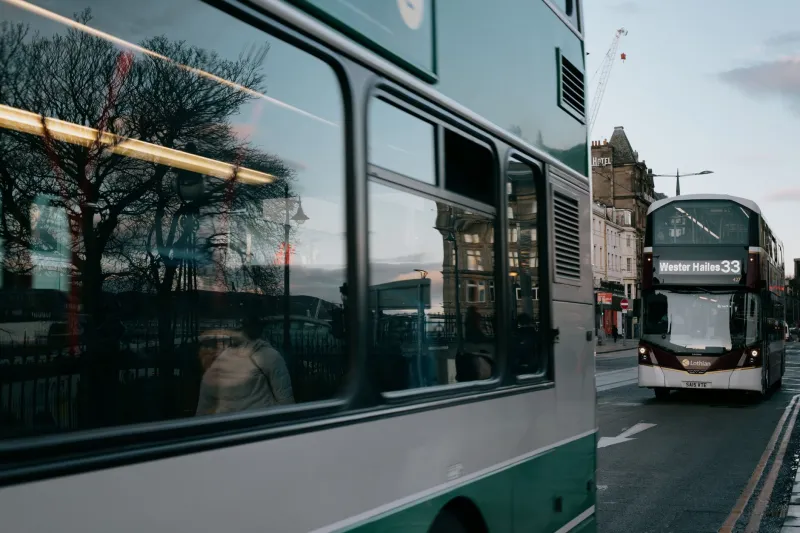
Bus services remain the backbone for many residents, particularly for trips into the town centre and onward connections. The practical questions are not only whether a route exists, but whether it runs at the right time of day, whether it is frequent enough to allow a return journey, and whether waiting environments are comfortable and safe. Evening and weekend timetables matter for people who work, care for others or rely on appointments outside standard hours.
Community transport fills some of the gaps left by scheduled services. Dial-a-ride, volunteer car schemes and accessible minibuses can be lifeline options, especially for older and disabled residents. The barriers here are often administrative as much as physical: eligibility criteria, booking windows, telephone-only arrangements and limited capacity can make a service feel uncertain even when it is well run.
Walking and wheeling are the most local forms of transport and the easiest to overlook. Pavement condition, dropped kerbs, crossing points, lighting, gradients, temporary obstructions and street clutter all shape whether a short trip is feasible. For people using wheelchairs, mobility aids or pushchairs, a route that looks short on a map can be long in practice.
Cycling is a realistic option for some residents, particularly for shorter trips, but confidence, storage, route continuity and weather all affect take-up. The last mile is not only about distance; it is about whether people feel the journey is safe and practical.
Where the gaps tend to appear
The 2026 picture is not one of a town without transport. It is a picture of uneven access. Several recurring gaps are worth naming.
Timetable mismatch. A bus may serve a route but not at the time a service is available. Appointments clustered in the early morning, or services that finish before the last return bus, create avoidable barriers.
Fare complexity. Single and return fares, concessionary schemes, companion passes and cross-boundary tickets can be difficult to navigate. For households on tight budgets, uncertainty about cost can be as discouraging as the cost itself.
Rural connections. Dunbar’s surrounding areas may have limited frequency, indirect routes or no evening service. The last mile becomes longer when a scheduled service stops short of a final destination or when a connection requires a wait in an exposed location.
Pavement and street infrastructure. Poor surfaces, missing dropped kerbs and obstructed footways create barriers that are invisible in timetable data but very real for residents.
Information access. Digital-only timetables and online booking systems exclude people who rely on print, telephone contact or face-to-face help. Good information is part of transport infrastructure, not an add-on.
A practical map for 2026
A last-mile map does not need to be a specialist geographic system. It can be a simple record of how people actually reach services. For each key service, planners could note the nearest bus stop, the frequency of service at relevant times, the walking or wheeling route, the availability of community transport, the fare implications and the main information source. Repeated across a small number of destinations — the health centre, library, council office, shopping area and community facilities — this would reveal patterns that individual anecdote cannot.
The value of such a map is that it moves the conversation from general statements about connectivity to specific, testable questions. It also gives service providers a way to compare notes. A transport provider may know the timetable; a service manager may know the appointment pattern; a community group may know the pavement problem. The last mile sits between them.
Questions for planners and providers
Clear questions are more useful than broad aspirations. The following are offered as a practical starting point for transport planners, service commissioners and providers working in and around Dunbar in 2026.
- Are service opening times aligned with the first and last bus arrivals that serve the relevant catchment?
- Can concessionary travel, companion passes and cross-boundary fares be explained in plain language and in print as well as online?
- Are community transport booking arrangements accessible by telephone and flexible enough for people who cannot plan far ahead?
- Are walking and wheeling routes to key services audited for surface quality, dropped kerbs, crossings, lighting and obstruction?
- Do rural connections allow a realistic return journey, including for people who need to travel outside standard hours?
- Is timetable and fare information available in places where people already go, such as libraries, GP surgeries and community centres?
- Are the needs of disabled residents, carers and people without digital access explicitly included in transport planning?
- Can providers and service planners share a simple last-mile checklist so that gaps are recorded consistently?
What residents can do
Residents do not need to wait for a formal review to report what they see. A missing dropped kerb, an overgrown footway, a confusing timetable or a bus that no longer connects with an appointment can be raised with the relevant council, transport provider or community group. Local feedback is most useful when it is specific: the location, the time, the service and the effect on the journey. Community organisations can also help by gathering that information in one place and passing it on.
The journey is part of the service
Dunbar’s services are strongest when people can reach them without undue difficulty. The last mile is not a peripheral concern for transport specialists; it is a practical test of whether community services are genuinely open to the people they are intended to serve. In 2026, the task is to make that journey visible, measure where it breaks down and ask straightforward questions of the organisations responsible for each link. Access begins before the doorstep, and it deserves the same attention as the services behind it.